Reconstructing Badenoch's Heritage Sites

Digital reconstruction of Ruthven Barracks (Bob Marshall)

In summer 2020, I began work on a new project which was to create a series of visual reconstructions of some of Badenoch’s rich archaeological sites for Badenoch The Storylands. We published the first two of the reconstructions - Ruthven Barracks and Dun da Lamh hillfort - in the autumn of that year to promote the project and to announce that a new digital app was being developed by Whereverly in Edinburgh. The Badenoch The Storylands App is a self-guided touring aid, featuring walking, cycling, and driving tours around Badenoch, highlighting over 75 points of cultural heritage interest in the area.

My digital reconstructions were turned into Augmented Reality (AR) models for the app and optimised so that they could run efficiently on mobile/handheld devices. The 3D models that I developed were also used to generate a series of images and videos with much higher levels of visual detail. Here, I explain a little about each of the reconstructions and the digital models I developed for the project.

Ruthven Barracks and Castle
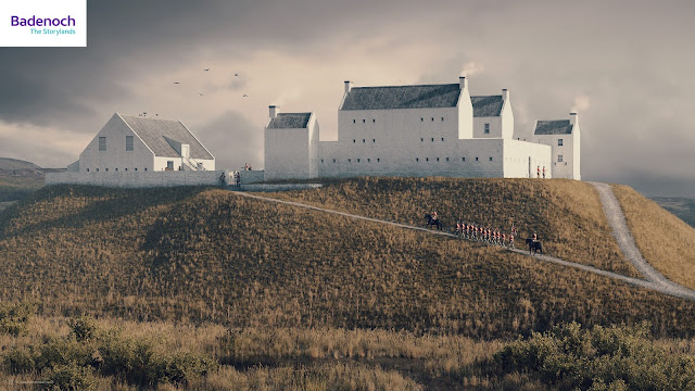
Digital reconstruction of Ruthven Barracks (Bob Marshall)

Built by George II’s government between 1719 and 1721 following the Jacobite rising of 1715, Ruthven Barracks housed infantry to enforce the Disarming Act of 1716. Although it is unlikely to have ever been fully garrisoned, the Barracks could hold two companies of soldiers – about 120 men – and their officers. On the orders of Major General Wade, a stable block was added to the west of the barracks in 1734, to be used by dragoons protecting troops marching along his military road. 


Digital reconstruction of Ruthven Castle by Bob Marshall
Digital reconstruction of Ruthven Castle, Badenoch c1398. © Bob Marshall

Before the development of the eighteenth-century Government Barracks, at least two earlier castles stood at the top of this same great mound overlooking the River Spey. This digital reconstruction shows Ruthven Castle as it may have looked around the late fourteenth century. This is the castle occupied by Alexander Stewart, the 'Wolf of Badenoch', who likely adapted this from an earlier stronghold belonging to the powerful clan Comyn. Accurately reconstructing this earlier castle is difficult because the Wolf of Badenoch's castle was then rebuilt by the Earls of Huntly - Chiefs of Clan Gordon - before being demolished and replaced by military barracks at the time of the Jacobite uprisings. My visual interpretation is partially influenced by the castles at Balvenie at Lochindorb - also former strongholds of the Comyns which were forfeited after the clan lost power when Robert I seized the throne in 1306.
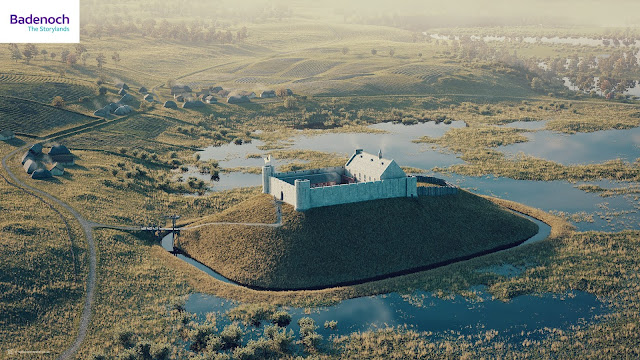
Digital reconstruction of Ruthven Castle by Bob Marshall
Digital reconstruction of Ruthven Castle, Badenoch c1398. © Bob Marshall

My reconstruction shows a rectangular curtain walled castle with two weakly projecting corner towers and a stone-built domestic range which may have had a large feasting hall and private chambers on its upper floor and a kitchen and service range beneath this. The wider view reconstruction shows the castle's relationship to the nearby village of Ruthven. The low-lying land immediately below the castle floods regularly during spring snowmelt and I was quite keen to communicate this in my reconstructions.

Ruthven Castle Digital Model by Bob Marshall
Ruthven Castle - Digital Model. © Bob Marshall

Raitts Township

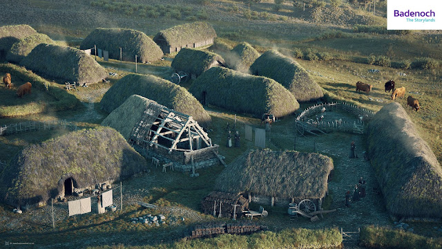
A digital reconstruction of Raitts Township, Badenoch in the early 1700s by Bob Marshall
Digital reconstruction of Raitts Township, Badenoch (early-mid 1700s). © Bob Marshall

Easter Raitts is a post-medieval township near Kingussie. My reconstruction shows how the settlement may have looked in the early-mid 1700s. The locations of the structures are carefully matched to survey drawings carried out by AOC Archaeology in 1995 (HER Monument MHG4411). The data from this survey was used to reconstruct the township at the nearby Highland Folk Park in Newtonmore, and which in turn has inspired my visual interpretation. 

Digital model...


Alvie Ring Cairn 

Digital reconstruction of Alvie Ring Cairn, Badenoch by Bob Marshall
Digital reconstruction of Alvie Ring Cairn, Badenoch. © Bob Marshall

This reconstruction of the chambered cairn monument at Easter Delfour near Alvie, is part of a well-defined group of stone-built monuments found around the Moray Firth and Central Highlands, the so-called 'Clava cairns'. It comprises a circular cairn with a platform on the outside, bounded by a ring of monoliths or standing stones. Here I combined survey data with influences from the Balnuaran of Clava near Culloden - one of the best-preserved Bronze Age cairns in Scotland.

Digital model...
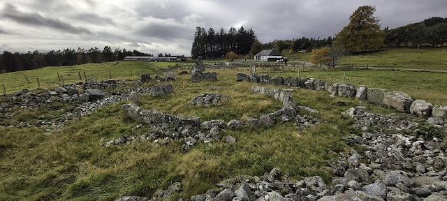

Alvie Ring Cairn Monument
 Alvie Ring Cairn Monument

Torr Alvie 

Digital reconstruction of Torr Alvie Hillfort, Badenoch by Bob Marshall
Digital reconstruction of Torr Alvie Hillfort, Badenoch (late Iron Age). © Bob Marshall

A speculative digital reconstruction of Torr Alvie hillfort. Although the site has never been excavated, the line of its rampart walls can broadly be determined by a stony bank that encloses an area of roughly 85m x 30m. It is similar in size and shape to Craig Phadrig hillfort near Inverness. However, unlike Craig Phadrig, there is no evidence that Torr Alvie was vitrified. It is difficult to know how thick the ramparts were, whether there were timber palisades, or how many entrances there were, so imagination plays a large part in this visualisation.

Digital reconstruction of Torr Alvie Hillfort, Badenoch by Bob Marshall
Digital reconstruction of Torr Alvie Hillfort, Badenoch (late Iron Age). © Bob Marshall

Digital model...


Raitts Souterrain

Digital reconstruction of Raitts Cave or Souterrain and late Iron Age roundhouse by Bob Marshall
Digital reconstruction of Raitts Cave or Souterrain and roundhouse (late Iron Age). © Bob Marshall

Known locally as Raitts Cave, this horseshoe-shaped subterranean chamber (souterrain) was first discovered in 1835 (MHG4405 - Raitts Cave). My digital model was created by referencing Lidar scan data provided by Historic Environment Scotland. We do not have the evidence to reconstruct what might have existed above ground, so I have speculatively shown the hypothetical relationship between the souterrain and an early roundhouse dwelling. I cannot be certain whether the chamber was accessed from within the roundhouse, or externally, so this interpretation should not be considered conclusive. I have attempted to illustrate something of early domestic life and what the souterrain would have been used for - in this case, for the safe storage of food and other valuables. 

This cutaway view showing the interior of the roundhouse and the subterranean chamber was one of the more challenging of the Badenoch reconstructions to create. I wanted to communicate the chamber within the context of the land above it and this had also to work effectively as a lower-detail AR model for use in the mobile app.

Dun da Lamh
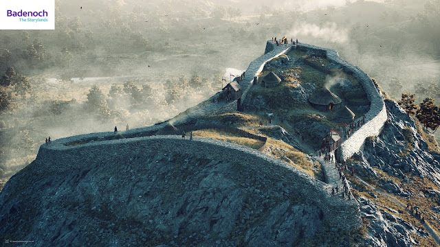
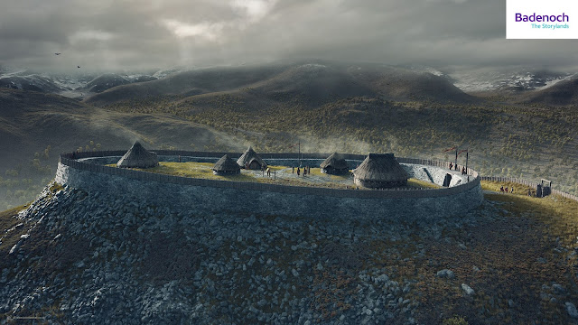
Digital reconstruction of Dun da Lamh hillfort, Badenoch by Bob Marshall
Digital reconstruction of Dun da Lamh hillfort, Badenoch (late Iron Age). © Bob Marshall

With no apparent signs of timber lacing, palisades, or evidence of vitrification like at Dun Deardail in Glen Nevis, Dun da Lamh somehow doesn't quite fit the image of the classic Iron Age hillfort. The ground at the summit is very rugged and uneven, with very limited platforms for building and therefore it feels unlikely that it was a permanent site for dwelling. Whether this fort had more than one entrance is also unclear. With extremely steep approaches on three sides, the possible entrances can be surmised by natural depressions in the topography where access is less steep. Was this fort simply a final place of refuge, or was it a place of ceremonial and ritual gathering, rather than primarily martial in purpose?

Digital model...


Technical information

All of these reconstructions have been created using a variety of different software packages. For the most part, I used the open-source software Blender 3D and E-Cycles for the modeling and rendering of scenery and assets. Adobe Substance Painter and Photoshop were used for texturing detail and post-render digital painting. Height data was purchased from Ordnance Survey to create some of the landscapes and I used QGIS to combine this with geo-referenced archaeological data where this was available. World Machine was used with imported height-maps to generate the backdrop of the Cairngorm Mountains for my reconstruction of Torr Alvie hillfort. 

Acknowledgments

I wish to end by offering a big note of thanks to the following people who generously gave assistance and feedback throughout this project: Eve Boyle, Adam Welfare, Iain Anderson, and Georgina Brown at Historic Environment Scotland. Prof. Richard Bradley of the University of Reading for his wisdom and advice on ring cairns and bronze age monuments. Matt Ritchie of Forestry Commission Scotland and Prof. Gordon Noble of the University of Aberdeen for their input and feedback on Dun da Lamh and Torr Alvie hillforts. Geoffrey Stell and Simon Forder for their assistance with Ruthven Barracks and Castle. I would also like to thank my clients, Badenoch Heritage, Cairngorms National Park Authority, and Voluntary Action in Badenoch & Strathspey, for inviting me to work on these reconstruction visuals and for allowing me the time to make these as detailed as possible. I hope that they will inspire people to visit Badenoch and take an interest in its rich heritage.

Finally, a posthumous thank you to the late Dr. Oliver O'Grady, who sadly and unexpectedly passed away just a month or so before this project commenced. Olly was project officer for Badenoch Great Place Project, he inspired and guided several of my previous visual reconstructions and introduced me to the world of hillforts. I hope my work here has done you proud, my friend.

Reconstructing St Mary's Collegiate Church, Youghal

St Mary's Church - How the nave looked in 1800.

I had the recent pleasure of working on a series of 3D animated reconstructions of St Mary’s Collegiate Church in Youghal, Co. Cork. The reconstructions visualise the building’s long and eventful chronology from 1250 to present day. In that time the church has undergone significant internal and external alteration to accommodate radical changes to worship – notably from the mid-sixteenth century onwards. These visualisations were commissioned for a large interactive touch-screen display - a feature of a new visitor exhibition at the church which opened in Summer 2021.

Working with a creative team led by interpretation consultant, Ann Scroope, and from research conducted by local historians, Dr. Alicia St Leger and David Kelly, I was able to bring St Mary’s past to life with three high-detail interior visualisations depicting the church in 1250, 1500 and 1800.

I created computer animations for the interactive to show the chronological development of the church and its free-standing tower over 700 years of its history.

The project presented me with several challenges: not being able to physically visit the church in the middle of a global pandemic with travel restrictions in place, and developing a way to simplify the visual information in the animations. Using measured survey drawings, photographs and archaeological data, my first task was to develop a computer model of the modern church which I could use as a starting point to visualise the church’s earlier architecture. For this, I combined the archaeological data and documented evidence collated by Alicia and David. Information referenced from other medieval churches helped us to fill some of the gaps in our information. The task of creating the computer models, animations, and interior renderings took approximately four months.

Councillor Mary Linehan Foley, Mayor of County Cork using the interactive.


Commissioned by Cork County Council / Scroope Design (Ireland) 2020/21. Two of the illustrations can be viewed in detail on my Artstation page.


Digital reconstruction of the chancel screen in 1500. St Mary's Collegiate Church, Youghal.


A (late) summer in Skye

I took some time off in November this year to visit Skye and Raasay for a late-season holiday with my wife, Rose. Never one to travel too far without my camera, I decided to put these words and pictures together in a mini photo-journal at the end of what has been a rather magical and unforgettable experience.

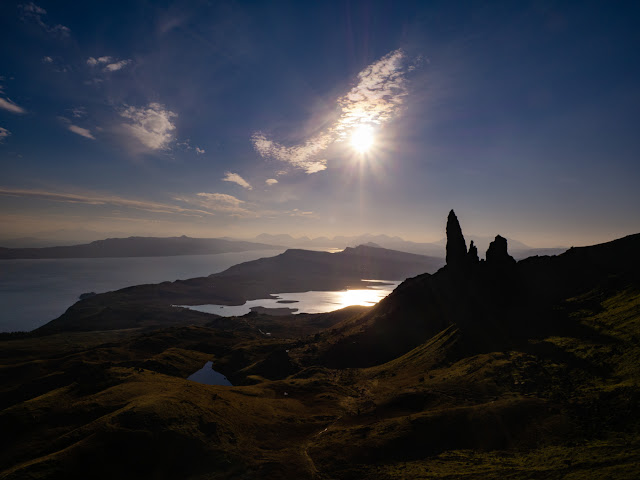
The Old Man of Storr, Isle of Skye.
The Storr, Isle of Skye
Although I was too young to remember the earliest trips, I know that I have been coming to Skye regularly since I was about two years old. I think it is probably the Scottish island I have visited most, the other being Shetland, although I have definitely been coming to Skye for a good deal longer. All I seem to remember of the times when I holidayed here with my parents were the never-ending car journeys along tortuously-windy single-track roads which are now mostly all dual-carriageway. The same journey can now be made in a few hours rather than the full day I vaguely remember it used to take. For the younger me, the two great highlights of the journey were just the slim chance that I may glimpse the Loch Ness Monster from the road somewhere between Drumnadrochit and Invermoriston and the ferry journey from Kyle of Lochalsh to Kyleakin which was massively exciting. I really miss those old ferries!

My father, Michael Marshall, worked as a producer in the BBC for many years. He was great friends with the late journalist and presenter Derek Cooper who spent a great deal of his time on Skye and who also wrote the gazetteer 'Skye' - its first edition published in 1970. Although it is now out of print, I think copies can still be found here and there (https://www.amazon.co.uk/Skye-Derek-Cooper/dp/0710068204). It was in the Skye town of Portree where Derek and his wife Janet spent their holidays and I faintly remember later trips to holiday with them. Day-outings to the west and Dunvegan or up to Trotternish and the narrow and twisty roads with rusty old cattle-grids and passing places on the way out to Staffin. I seem to remember spending a bit of time up at places like Skeabost or Stein Inn, or going for lunch at the Cuillin Hotel in Portree, but probably not being allowed anywhere near the bar in those days! And I also remember making the walk to the local baker every morning except on the sabbath day of course, to collect wonderful, freshly-baked sugary doughnuts, usually accompanied by my mother or by my grandfather, Alec Marshall.

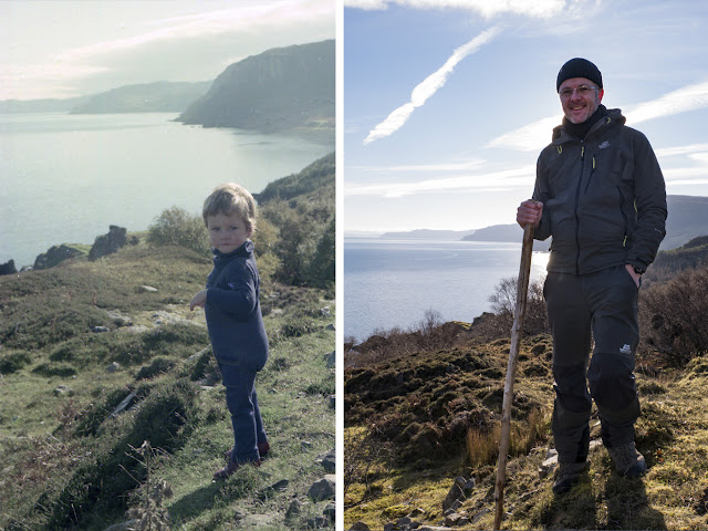
A trip that I remember nothing of, however, was over to Raasay. I only know I have been here thanks to a series of wonderful photographs taken by my father and which I greatly treasure. One of these photos shows a two-year-old Robert (Bob) Marshall, me, being carried by Malcolm (Calum) MacLeod in 1975 along a stretch of the now fabled road that bears his name and which he single-handedly constructed over a period of ten years between 1964 and 1974 with little more than a shovel, a pick and a wheelbarrow. I only came to realise the enormous scale of this man's achievement in my adult years and having read his compelling story written in 2006 by Roger Hutchinson (Birlinn. ISBN 978-1-84158-447-8). And it was around this time that my mother handed me the photograph of me being carried along the road by none other than the man himself in 1975 when I was two years old.

Left: Calum MacLeod holding the young Robert (Bob) Marshall aged two in 1975.
Right: Bob Marshall revisits Calum's Road in 2018, 43 years later.
In 1975, my family visited Raasay as part of our holiday on Skye. At this point, Calum had completed construction of his road and the photograph shows what I am thinking must be the final few hundred metres of this leading to his croft at Arnish. The road was not surfaced with tarmac until 1982 when the council finally adopted it but by then, Calum and his wife, Lexie, were the last remaining inhabitants of Arnish. Calum died in 1988.

Since reading Roger's book, I had planned to visit Raasay to retrace my childhood footsteps and to walk the road that Calum built by hand. In November 2018, my wife Rose and I took a few days off from our busy schedule to visit Skye and Raasay for a belated summer holiday. We were astonishingly lucky to have been blessed with several days of excellent weather and I had some great opportunities to visit some fabulous castles (most of which I have visited before) and I also got to do a bit of walking too!

Rose and Bob Marshall walking Calum's Road
Rose's mother's surname is Macrae which is indigenous in the Skye and Lochalsh areas, as is the name MacLeod, and we believe that it is through Rose's grandmother's MacLeod name that, Calum MacLeod who built the road, may actually be a relation. So, Rose and I both had a shared interest in discovering more about Calum's background. She's been doing quite a lot of research in order to write a small book on her ancestry and much of our holiday was dedicated to tracing her family roots and connections which I found it extremely fascinating. It was wonderful to spend time with some of her relations and also to speak to a few local people who are extremely knowledgeable about the Macrae history and their genealogy. Our travels over these six days took us to Kintail and Eilean Donan Castle, Duirinish, Plockton, The Archives Centre at Portree, Kyle of Lochalsh and Raasay.


The cathedral-like spires of the Old Man of Storr, Isle of Skye.
The cathedral-like spires and pinnacles of the Storr, Isle of Skye
Low winter sun behind the Storr, Isle of Skye

On the day that Rose spent in the Archives at Portree, I took a wee wander up to the Storr to enjoy perhaps one of the finest late autumn days I have experienced in recent years. With the sun out, it was pleasantly warm, but perhaps the most memorable experience was the absolute silence. There wasn't a breath of wind and it was just possible to make out the voices of people in conversation almost a kilometre away from where I was standing. The tall cliffs behind the Storr form a natural amphitheatre and amplifier making sound travel and reverberate over longer distances. This, combined with the sun casting interesting light rays through gaps in these cathedral-like rock spires, made it a rather spooky and magical spectacle.

Dun Telve Broch, Glenelg
Although this was not part of our research, we took a trip down to Glenelg to see the two iron-age brochs of Dun Telve and Dun Troddan. These remarkably-intact structures are a fascinating glimpse into the ancient lives of our distant ancestors. I've visited a few brochs around Scotland, especially those in Shetland, but the Glenelg brochs are unique in their own individual ways and this was the first time I have had a proper chance to look at them in detail.

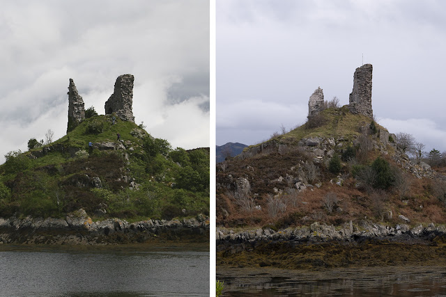
On the same morning I paid a quick re-visit to Caisteal Maol (Castle Moil) at Kyleakin. I last visited and photographed this castle in 2015, however in February 2018, the castle was struck by a bolt of lightning which destroyed part of the top half of the Northernmost remaining wallhead causing it to collapse. The ruin has since been stabilised to make it safe. The remains of the original wallhead now spill down the northern flank of the ancient dun on which the castle is built. It was interesting to note that the ruin has now been fitted with a lightning conductor!

Before and after images of Caisteal Maol, Skye in 2015 and 2018 showing the extent of the lightning storm damage.
Left: Caisteal Maol, Kyleakin, Skye (2015).  Right: Caisteal Maol, Kyleakin, Skye (2018) showing the extent of the damage caused by a lightning storm in February 2018.

Ferry from Sconser to Raasay
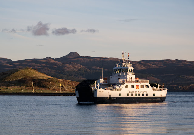
Ferry from Sconser to Raasay (operated by Caledonian MacBrayne)
Our day over on Raasay started fairly early. We picked the day that had the best weather and set out to catch the early ferry from Sconser to make the most of the available daylight. It gets dark very quickly, around about 4.30pm, at this time of year and we knew we had a lot to see and do while we were on the island. Our first objective was to walk the entire length of Calum's Road. Although we had taken the car with us and could perfectly well have driven the 1¾-mile road, I simply could never have lived with myself not having paid proper homage to Calum by driving it! I had to walk along his road in order to ponder on and savour his monumental effort - ten years of back-breaking labour.

Brochel Castle, Raasay
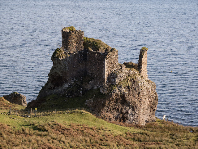
Brochel Castle

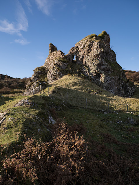
Our starting off point for the walk was Brochel. This is the site of a rather magnificent castle of the same name. What is left of this now ruinous late 15th/early 16th century stronghold clings perilously to a tall stack-like volcanic plug of rock. It is in a highly-dangerous state of disrepair and fenced off for obvious safety reasons. I decided that it would be for the best to take heed of the various notices posted around about the foot of the castle warning of falling masonry and imminent collapse. The entrance to the castle was originally on the eastern, seaward side of the castle. It doesn't look like it would be terribly difficult for an able-bodied man like me to scramble up and access the castle, but I don't think it would be wise to take the risk, nor indeed the chance that I may cause further damage to this fabulous ruin in attempting to access it. I much prefer to observe from a respectfully safe distance!
Brochel Castle, Raasay
Brochel Castle (entrance to the east)
Brochel is located in a wonderful spot close to the beach affording fantastic views over the Sound of Raasay to the Applecross Peninsula. It is easy to understand why a castle was built here by Raasay's first Macleod chief, Calum Garbh or (later) Calum MacGilleChaluim, and afterwards occupied by the Macsweens.

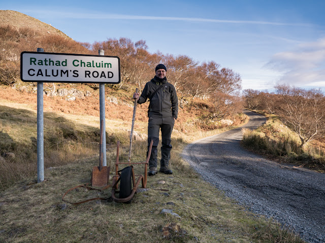
Bob Marshall at the start of Calum's Road at Brochel, Raasay
The start of Calum's Road at Brochel

At Brochel begins the start of Calum's Road. Around almost every bend, kink, rise and dip in the road, there are indications that this marvel of road-building was no easy feat. Even for modern machinery, I would expect it would have presented quite a reasonable engineering challenge. That Calum managed to build this all this on his own, and the fact that later workmen had very little, if any remedial work to do to prepare this road for its tarmac surface is truly awe-inspiring.

Our journey along the road that Calum built was made all the more special with the chance to meet with Calum's surviving daughter, Julia, who just happened to be staying at Arnish at the same weekend that we were visiting. It was a truly wonderful encounter and the chance for Rose to make a connection with the MacLeod side of her family.

Calum's Road
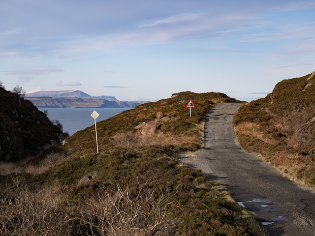
Calum's Road - view looking North towards Staffin in the distance

Robert Marshall (aged 2) in 1975 and Robert (Bob) Marshall in 2018
Left: Young Robert (Bob) Marshall on Calum's Road at Brochel 1975.
Right: Bob Marshall on Calum's Road at Brochel 2018.
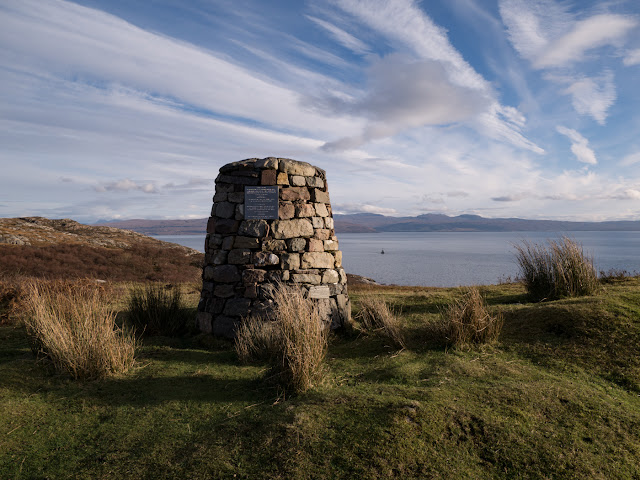
The cairn commemorating Calum MacLeod's achievement.
The cairn commemorating Calum's achievement
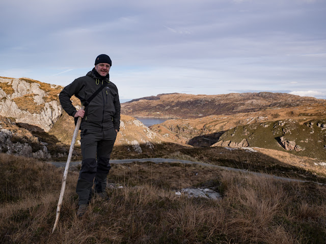
Bob Marshall standing roughly half way along Calum's Road where the road drops steeply down towards a small inlet at the head of Loch Arnish
Standing roughly half way along Calum's Road where the road drops steeply down towards a small inlet at the head of Loch Arnish.
My mother, our old car and me at Brochel Castle, Raasay in 1975

Calum MacLeod and my father, Michael (carrying me) across a hayfield at Arnish Croft in 1975
Arnish croft in 1975

View from Raasay looking South-west towards the Cuillins

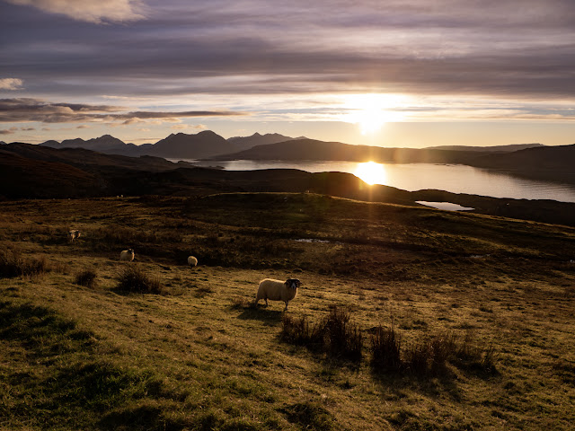
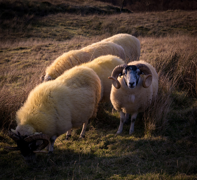
Sheep grazing on Raasay


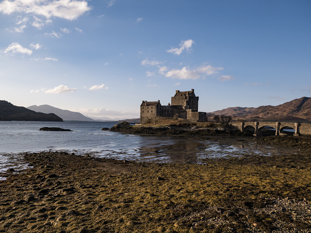
Eilean Donan Castle.
Eilean Donan Castle
With thanks to my father for the use of the photos of Calum's Road and Arnish, 1975 and also to my lovely wife, Rose, for taking some of the photos of me and for being such fantastic company for the six days we spent up here.

All photos © Bob, Rose and Michael Marshall 1975 & 2018


Links:

Calum's Road
https://www.undiscoveredscotland.co.uk/raasay/calumsroad/index.html
Roger Hutchinson's book -  https://www.amazon.co.uk/Calums-Road-Roger-Hutchinson/dp/1841586773/ref=tmm_pap_swatch_0?_encoding=UTF8&qid=&sr=

Brochel Castle
https://canmore.org.uk/site/11504/raasay-brochel-castle
http://www.isleofraasay.com/index.php/2016/11/05/brochel-castle/

Dun Telve and Dun Troddan Brochs
https://www.historicenvironment.scot/visit-a-place/places/glenelg-brochs-dun-telve-and-dun-troddan/

Caisteal Maol
https://canmore.org.uk/site/11663/skye-kyleakin-caisteal-maol

Eilean Donan Castle
https://www.undiscoveredscotland.co.uk/dornie/eileandonancastle/index.html


Visualising confined interior scenes elegantly in Blender 3D

Final render: Reconstruction of the kitchens, Orford Castle.

I thought I would quickly pen this article having recently run into some awkward problems while tackling visualisations of some extremely confined interior spaces. I am sharing this in case it may help or offer some pointers to anyone else tasked with a similar problem. I am using my reconstructions of Orford Castle in Suffolk, produced for English Heritage, as an example here.

When setting up my 3D models in the Blender 3D software, the usual and most obvious way to fit most of the scene into the final image is to set a very wide angle camera lens. But the drawback with wide angle lens settings is that they tend to create a lot of distortion in the image which just doesn't look visually pleasing. So, I prefer to use longer focal lengths of between 40mm and 70mm but that means of course, that we won't get to see all of the room in the image. How did I tackle this problem, then?

Well, I cheated.

In Blender 3D, you can bend the rules somewhat. There are some nifty camera settings that emulate often prohibitively-expensive tilt-shift lenses which are used a lot by architectural photographers. Using a combination of camera rotation and adjusting the camera's X and Y shift values, it's possible to correct some of the distortion that comes with the wider angle lens settings. You can also play with the camera's sensor size and choose a setting that emulates a real full-frame camera - and even beyond that! But sometimes even this doesn't quite provide enough flexibility. So this is when it's time to roll out the big hacks.

When visualising Orford Castle's prison, I had faced the following challenges:


  1. I needed to show as much of the interior space as possible,
  2. The room is VERY dark - there is only one tiny natural light source,
  3. I needed to make the image very tall so that we can see how the prison was accessed via a rope-ladder and trap-door,
  4. I have to minimise the amount of lens distortion in the image to create a pleasing image,
  5. The scene needed to be accurately lit.
Positioning the camera inside the room with a wide angle of view resulted in this extremely distorted and completely unsatisfactory image.

 I decided quite early on with this scene that choosing a wide angle lens wouldn't work here. What I needed was a way to position my camera at a distance just far enough away from my model that I could use a focal length of 60mm-70mm to avoid distortion and fit in as much of the prison's interior space as I could.


To do this I positioned my camera well outside of the model and set its image dimensions to 2500 x 5000 px which will produce for me a nice, detailed render of the full prison space. But now I have a wall with a backface obscuring the view of the prison's interior. It might seem like a straight-forward task of just deleting or hiding the wall in the scene, but the problem is that this hides the wall from both the camera AND the scene. The environment lighting that I have set up to illuminate the room (through a small window) penetrates the room through the void left by the missing wall, which is no good at all.

The surprisingly simple workaround here is to employ Blender's Light Path material node which controls what elements in a scene the camera will see in the render. There are some good tutorials out there on the web which explain this very useful node in more detail, but for my example I am using the Is Camera Ray output of the Light Path node as the factor for mixing two of Blender's material shaders -  the Principled and Transparent shaders. This is making the obscuring wall transparent or invisible to the camera, but still visible to the rest of the scene so that lighting can be calculated accurately.

By positioning my camera some distance outside the room and using Blender's Light Path node to hide the backfacing wall from the camera, I could use a much longer focal length resulting in far less image distortion.

The final result of the render. The Prison, Orford Castle. Accurately-lit and no ugly lens distortion!

I used this same technique on Orford Castle's kitchens (image at top of page) - although in this example I did use a slightly wider camera focal length, with some distortion in the lower part of the image, it still gave some reasonably pleasing results.